

PRC-VA 61 Vuelta a San Marugán(Return to San Marugán)
PRC-VA 61 Vuelta a San Marugán(Return to San Marugán)
Route information
El sendero recorre una zona de páramo calcáreo, situada entre las localidades de Portillo y Cogeces de Íscar, atravesando por una interesante masa forestal mixta de pino, encina, quejigo y sabinas de gran interés biogeográfico. El sendero tiende a ir bordeando el páramo, lo permite obtener fantásticas vistas del paisaje de cuestas, páramos, valles, vegas y pinares representativos de esta parte oriental de la provincia de Valladolid.
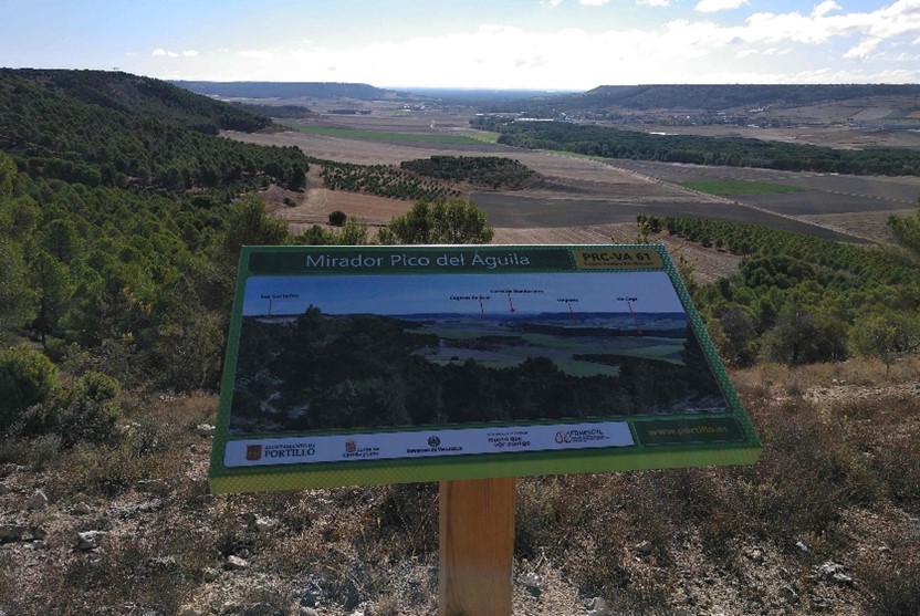
Uno de los puntos de mayor interés del recorrido son los cantiles que dejan a la vista estratos del subsuelo que pisamos. Interesante por la vista, por la curiosidad geológica que se destapa y por el hábitat de rapaces y otros animales habituales en este territorio. Otro de los enclaves privilegiados de la ruta e incluso de la provincia vallisoletana es el Pico del Águila, promontorio geológico que esconde este monte. Otro punto de interés es el Mirador sobre la Cañada Real.
Stages
The path runs through an area of ??calcareous moor, located between the towns of Portillo and Cogeces de Íscar, crossing through an interesting mixed forest mass of pine, holm oak, gall oak and juniper of great biogeographical interest. The path tends to skirt the páramo, allowing you to obtain fantastic views of the landscape of slopes, páramos, valleys, meadows and pine forests that are representative of this eastern part of the province of Valladolid.
One of the most interesting points of the tour are the cliffs that reveal layers of the subsoil that we walk on. Interesting for the view, for the geological curiosity that is uncovered and for the habitat of birds of prey and other animals common in this territory. Another of the privileged enclaves of the route and even of the Valladolid province is the Pico del Águila, a geological promontory hidden by this mountain. Another point of interest is the viewpoint over the Cañada Real.
Trail ride
Área Recreativa de San Marugán - Los Cantiles - Pico del Águila - Despoblado Barcelona - Mirador de la Cañada- Área Recreativa de San Marugán
Weather in
Route data
Circular: Si
Desnivel(m): 80
Dificultad: Baja
Duración Aproximada: 3h 30'
Longitud: 13,6 Km
Señalizada: Si
Tipo de Ruta: a pie, en bici